Module 2: Water Transport
Concept
Subtopic 2.1: Waterways of Bihar
- The broad Ganga allows boat transport. Though water transport has no special place, a steamer service crosses the Ganga at Barari Ghat-Mahadevpur Ghat for Bhagalpur (less used after a bridge near Mahadevpur); there is also one for Mokama-Barauni.
- The Ara canal from the Son canal carries boats along its full length and steamers for 83 km.
- For commercial cargo, a jetty was built at Gaighat (Patna), helping vessels on the Kolkata-Varanasi waterway to halt, load and unload. Diara people depend on this route for local travel.
- National Waterway-1 (Allahabad to Haldia) passes through Bihar. The Ghaghara, Gandak, Burhi Gandak and Kosi are navigable; in South Bihar the Son and Punpun are navigable for some distance (the Son farther).
- For safe navigation, Bihar framed the 'Model Navigation Rules, 2011' on the lines of the Bengal Navigation Act, 1885.
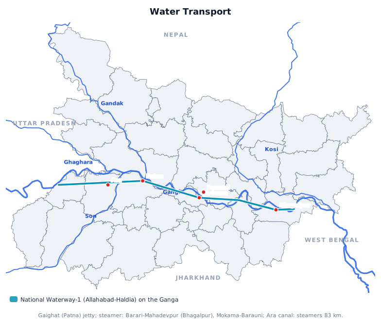
- Allahabad to Haldia.
- Gaighat.
- 83 km.
- Bengal Navigation Act, 1885.
- Son and Punpun.
- Barari Ghat-Mahadevpur Ghat.
- Ghaghara, Gandak, Burhi Gandak and Kosi.
- Question: National Waterway-1 extends between which places? Answer: Allahabad-Haldia.
- Question: Where is the cargo jetty in Patna? Answer: Gaighat.
- Question: For how many km do steamers run on the Ara canal? Answer: 83 km.
- Question: On what model were the 'Model Navigation Rules, 2011' framed? Answer: Bengal Navigation Act 1885.
- Question: Which South Bihar rivers are navigable for some distance? Answer: Son and Punpun.
- Question: The steamer for Bhagalpur crosses the Ganga at which ghats? Answer: Barari Ghat-Mahadevpur Ghat.
- Question: Which of these North Bihar rivers is listed as navigable? Answer: Burhi Gandak.
MCQs
Answer this question, then use Next.
Question 1: National Waterway-1 extends between which places?
Question 2: Where is the cargo jetty in Patna?
Question 3: For how many km do steamers run on the Ara canal?
Question 4: On what model were the 'Model Navigation Rules, 2011' framed?
Question 5: Which South Bihar rivers are navigable for some distance?
Question 6: The steamer for Bhagalpur crosses the Ganga at which ghats?
Question 7: Which of these North Bihar rivers is listed as navigable?
One-liners
Write your answer, then submit to see the correct answer.
National Waterway-1 extends between which places?
Allahabad-Haldia.Where is the cargo jetty in Patna?
Gaighat.For how many km do steamers run on the Ara canal?
83 km.On what model were the 'Model Navigation Rules, 2011' framed?
Bengal Navigation Act 1885.Which South Bihar rivers are navigable for some distance?
Son and Punpun.The steamer for Bhagalpur crosses the Ganga at which ghats?
Barari Ghat-Mahadevpur Ghat.Which of these North Bihar rivers is listed as navigable?
Burhi Gandak.